UK weather: Thunderstorm warning for England and parts of Wales
Forecasters have issued alerts for thunderstorms and heavy rain on Sunday, affecting a large portion of England and some areas in eastern Wales.
The Met Office has warned that there is a slight possibility of flooding and disturbances in certain areas.
The alert for people to "take note" is in effect starting at 04:00 BST and it applies to extensive areas in southern England, the Midlands, and the north.
Weather experts are cautioning that thunderstorms and intense rain will be forming in the southern part of England on Sunday morning, then heading towards the north throughout the day.
In England, a region in the middle of the country from the Isle of Wight to Newcastle upon Tyne is under the alert.
In Wales, there is a caution for Monmouthshire, Newport, Torfaen, and Wrexham in the eastern part of the country.
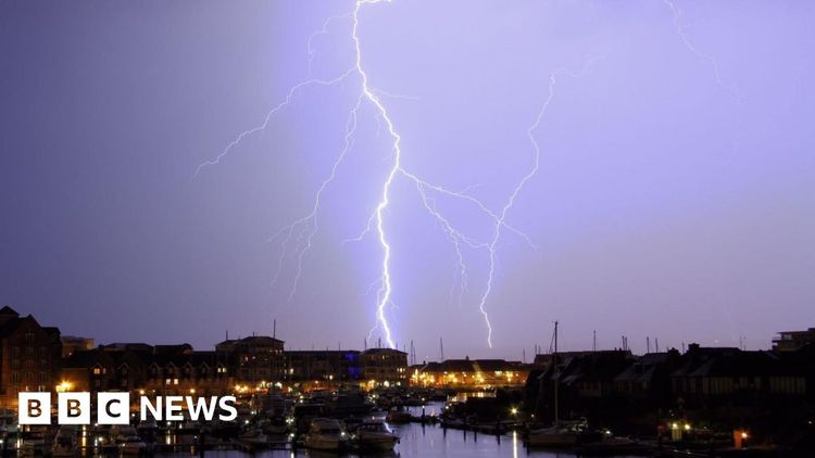
The Met Office warned that flooding is possible and also mentioned that there could be frequent lightning strikes and hail as extra dangers in southern and central England.
On Sunday, the BBC Weather predicts that the UK will experience a influx of hot and sticky air coming from the southeast.
This will also result in some heavy rain showers with thunderstorms, which will travel northward through the central part of England and eastern Wales.
These thunderstorms may not be widespread, but in areas where they do happen, there could be heavy rainfall, strong winds, and lightning.
Finding the exact locations of these showers can be challenging, but it would be beneficial to keep yourself informed with the most recent weather forecast as it may be updated, according to BBC weather.
With the higher and damp air, many regions will experience temperatures reaching around 20 to 25 degrees Celsius, and some areas in the southeast of England may even reach up to 27C.


