Snow to hit London next week as deep freeze continues
London is going to encounter an additional snowfall next week, owing to the anticipated decrease in temperature.

According to the Met Office, it is expected that there will be light snow showers and sleet in the capital, which will likely start in the afternoon of Wednesday, January 17th and persist until the evening.
It's going to get even colder next week with temperatures plummeting below freezing. On Monday, it's expected to be the chilliest day with temperatures as low as -3C in some parts of north-west London like Hampstead. It'll feel even colder, like -6C.
After some extremely cold days in the city, with a chilly beginning on Thursday that gave off a sensation of -1C.
The Met Office cautioned that there might be considerable snowfall in other parts of the United Kingdom next week.
On Monday, some regions of the country were already covered in snow, which caused the UK Health Security Agency to issue an amber alert for health in the north-west of England, the West Midlands, East Midlands and south-west England. This alert will remain in effect until Friday at noon.
This means that the entire healthcare system is expected to experience the effects of the cold weather for a long time.
London's Mayor, Sadiq Khan, recently initiated an emergency initiative to provide aid to homeless individuals after the weather dropped in temperature. The city received its first snowfall of the year, and an ice warning was put in place until 3am the following day. The operation's objective is to ensure that rough sleepers are no longer exposed to unsafe environmental conditions.
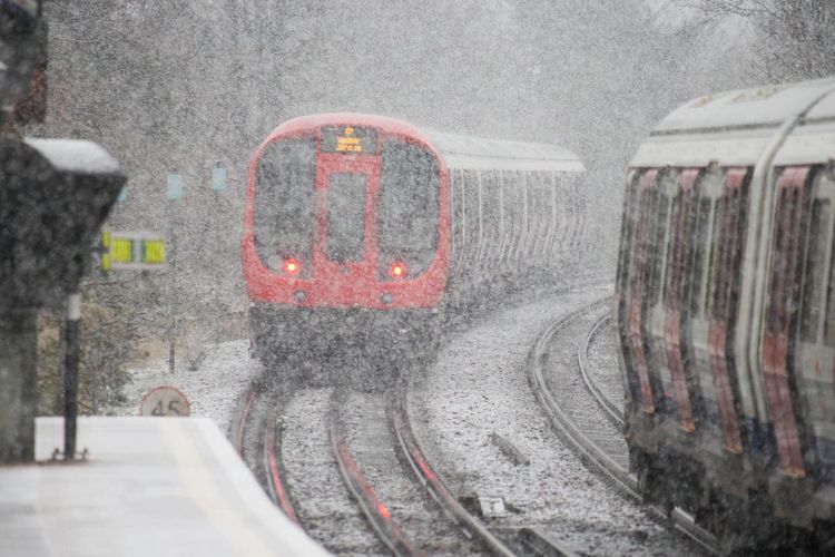
People in London began to notice snowfall in areas such as Orpington, Croydon and Beckenham from around 10.30am on Monday. There were additional snow flurries across the city that persisted throughout the afternoon and evening.
In certain areas of London, the weather conditions were quite chilly on Monday afternoon, with temperatures dropping to as low as -5C.
The harsh climate is a result of a high-pressure system that is bringing temperatures lower than what is expected during this season.
On Thursday, the Met Office gave an update stating there may be snow that causes problems next week. It could first affect Scotland and Northern Ireland but also has a chance to happen in other areas with the possibility of a lot of snow.
According to David Hayter, who is the Deputy Chief Meteorologist at the Met Office, it seems that there is a high chance of snow occurring in coastal areas located in the north of the United Kingdom. These areas include coasts in the North Sea and Irish Sea regions. However, it is expected that there will also be some snowfall that could cause problems during the middle to latter part of next week.
We're closely monitoring the collision between warmer air from the southwest and the cold air already in the UK. This is where we expect snow to form in certain areas.
Right now, there are multiple possibilities being displayed by models regarding the timing and execution of this scenario. As time passes, we will be able to provide more specific information.
Meteorologists from the Met Office have stated that they have a notion of "the particular arrangement we are examining".
X shared a video on Tuesday to explain that there will be a northerly airflow accompanied by snow showers in the country.
Even though it is chilly and refreshing, such weather often brings abundant sunshine too.
Forecasters have predicted that the Atlantic will likely bring in low pressure from the southwest, indicating a return of its presence.
A specialist from the Met Office stated that the issue with this situation is that once it arrives and begins to blend with the chilly air, it will exacerbate the already existing northerly coldness throughout the UK.
When moist and warm air come in and meet low pressure from the southwest, snow usually forms when the mixture reaches cold air.
It's impossible to predict the exact location of the event, its duration, or the intensity.
These are the types of circumstances that could result in considerable snowfall in certain parts of the UK. So, it's essential to monitor them closely.
A lady was covered in warm clothes in Covent Garden during Monday.
According to the Met Office, there will be chilly and mostly rainless weather for the majority of this week, with the southern regions being extra cold compared to the usual.


